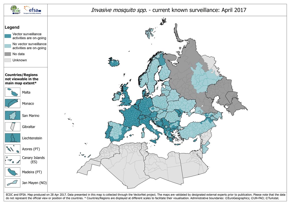
Invasive mosquitoes: Surveillance map in Europe, April 2017
The map 'Invasive mosquitoes' shows the current known vector surveillance activities in Europe, as of April 2017. The VectorNet maps are published regularly on the website to provide the ECDC stakeholders and the general public with the most up-to-date information on vector distribution.
Download

The surveillance activities include not only specific surveillance studies but also work done as part of on-going control activities, research projects and inventory studies.
ECDC and EFSA, through the VectorNet network, continues to improve the data collection for the maps. VectorNet is looking for vector-borne disease experts who are interested in sharing data on the distribution of mosquito, tick, sand fly and culicoides vectors. Experts can contact VectorNet at VectorNet@ecdc.europa.eu to join the network. They can also register and upload data to the common database through the VectorNet tool.
Suggested citation: European Centre for Disease Prevention and Control and European Food Safety Authority. Mosquito maps [internet]. Stockholm: ECDC; 2018. Available from: https://ecdc.europa.eu/en/disease-vectors/surveillance-and-disease-data/mosquito-maps
Mosquito maps


Read more
European network for medical and veterinary entomology (VectorNet)
VectorNet is a joint initiative of the European Food Safety Authority (EFSA) and the European Centre for Disease Prevention and Control (ECDC).